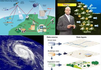
Disaster management is one of the important areas where a nation has to look into and make sure this process is well equipped. No one knows when a country may hit by any disaster and emergency springs into action. Since many decades, government of various countries has relied on private agencies to interpret emergency signals and make sure the calamity is managed well. One has to respond at the earliest to the natural or man-made calamities, to refrain the nation from maximum casualties. As stated, disaster can be either natural or man-made. Irrespective of the case, disaster management has to be strong enough for the nation to survive its impact. Since last few decades, we have witnessed a growth in the occurrence of the disasters. World has been struck with fairly good number of big scale disasters which has taken toll of lives in numbers. Likewise, disaster management is an approach wherein by means of disciplined ways one has to devise strategies to bring down the impact of these disasters along with providing relief to the affected population.
Over the years science and technology has progressed to an extent that it provides its assistance in every walks of life. Disaster management has also been touched by the progress in the technology. The intense understanding of distribution and impact in time and space has expanded enormously, resulting into efficient predictions and also better preparations of steps to be taken in case of crisis. Great progress has been made in the arena of meteorological models which has helped in turn to predict the weather efficiently and with great efficacy. Although earthquake cannot be predicted as of today, but many options do exist to make somewhat accurate forecasts and save lives by timely evacuation of people and animals. The progress in design and construction technology has made structures strong enough to resist the earthquakes and be firm in times of crisis or calamities.
Flood is one of the many disasters which leave many people homeless and also take away many lives at the same time. Information Technology has played a vital role in managing the flood. An example of successful implementation of such initiatives can be seen in Vietnam. Vietnam is an area which is prone to maximum water borne disasters. Here, using a system which bridges Central Committee for Flood and Storm Control (CCFSC) and Disaster Management System (DMS) with Hydro-Meteorological services (HMS) helps to provide pointers on following aspect of disaster:
- Forecasting disasters.
- Warning and responding to disasters.
- Information on Damages.
- Rescue operation.
- Relief measures.
- Restoration facilities.
- Rehabilitation services.
The above system has proven to be effective in providing information to the people, warn them about the impending disaster, help people at times of crisis and generate awareness on disaster management. Apart from this initiative, following technological platforms are in place to assist in disaster management:
– World Weather Watch (WWW): It is targeted towards generating and real time exchange of data, availability of forecasts etc.
– Public Weather Services (PWS): It helps in coordinating the forecast and respective information.
– Tropical Cyclone Programme (TCP): It assists in building efficient systems to fight against tropical cyclones and its subsequent consequences.
– World Climate Programme (WCP): By means of Climate Information and Prediction Services (CLIPS). It helps countries to apply climate information and respective data for predictions and early warnings of climate related disasters.
– World Weather Research Programme (WWRP): This aims towards development of cost effective means to manage disasters like cyclones, floods, sand and dust storms etc.
– Hydrology and Water Resources Programme (HWRP): It helps in assessing the risks of water related hazards with major focus on water related disasters.
– Regional Specialized Meteorological Centers (RSMC’s): Its main aim is to provide early warnings and accurate global forecasts etc to address emergencies such as nuclear accidents which may be an aftermath of natural disasters.
GIS Technology: Geographic Information System (GIS) is a technology through which every department can share the data on one single platform. Disaster management has to be carried out by every department in the state and country level based on the level of impact. Single department cannot carry out the said activities single handedly. Through GIS, all the information pertaining to the respective emergency and crisis situation can be accessed all at once which otherwise would have been very difficult at an individual institutional level. Using this technology, much time is saved at times of crisis thereby reaching out to needy as the need arises. In GIS, the departmental officials can visualize the impact of the disasters and also evaluate the consequences at the same time. This is also complemented by the map data which helps them to prepare the mitigation plan and also the recovery strategy without wasting much time.
Space Technology: Space technologies are very much vital in disaster management. They are the primary source of information which later on can be used at times of crisis. Images provided by the Earth observation (EO) satellites help to gather information on the upcoming disaster along with the recovery and rehabilitation efforts towards the same. Global Navigation Satellite Systems (GNSS) like Global Positioning System (GPS) helps by providing the exact location along with the infrastructure data so as to manage the crew coordination during disaster management. Communications via the satellite (SATCOM) helps in transferring the data when regular communication channel is being affected by a disaster.
Advances in science and technology have helped to reinforce the early predictions and preparedness against a disaster. Even though the technology helps in disaster management it is of utmost importance to act calmly and in a systematic and synchronized manner.
